
My name is Endy Arfian. I do a lot of work in the forestry sector, web-developing, and designing. I'm very passionate and dedicated to my work. With 5+ years experience in those sector, I have acquired the skills and knowledge.
ENDY ARFIAN
I am ForesterDeveloperDesigner

Endy Arfian F. P.
I am ForesterDeveloperDesigner
- Endy Arfian F. P.
- 01 January 1994
About Me
Quality Services
- Website Development
- Creative Design
- 2D/3D Animation
- Geographic Information System
- Forestry Data Analyst
Programming Skills
PHP70%
Java Script50%
Database75%
Other Skills
Language Skills
Education Timeline
- 2014 - 2021
Universitas Gadjah Mada
Bachelor's Degree of Forestry - 2009 - 2013
STM Pembangunan Yogyakarta
Associate Degree of electronics major
Working Timeline
- 2014 - Running
Freelance
Creative Designer, 2D/3D Animator, Web Developer - 2021 - 2023
Geo Circle Indonesia
Spatial Data Analyst - 2019 - 2020
Agri Muda Swasembada Foundation
Social Media Content
Primary Projects Timeline
- 2024
DISHUT JATIM
Database Engineer & GIS Specilist
Inventarisasi Hutan Rakyat Provinsi Jawa Timur - 2024
Primamulti Buana & UGM
Surveyor & GIS Specilist
Penaksiran Cadangan Karbon dan Keankaragaman Hayati - 2023
BRGM & UGM
Web Developer & Database Engineer
Penyusunan dan Pembuatan Sistem Informasi Gambut dan Mangrove - 2022
Bukit Asam & UGM
Data Analyst
Penaksiran Biomassa dan Cadangan Karbon Tegakan Hasil Reklamasi - 2022
Fakultas Kehutanan UGM
Web Developer & Database Engineer
Penyusunan RPJP KHDTK Fak. Kehutanan UGM - 2021
Blitar Gov. & UGM
Enumerator
Penyelesaian Penguasan Tanah dan Penataan Kawasan Hutan - 2021
Fakultas Kehutanan UGM
Field Coordinator
Riset Pemandatan Kawasan Hutan Dengan Tujuan Khusus - 2021
DLHK Sleman & UGM
Surveyor & Data Analyst
Kajian Analisis Spasial Pesisir Pantai Selatan DIY - 2019
BPDASHL SUMUT & UGM
Surveyor & Data Analyst
Penyusunan Rencana Teknis Rehabilitasi DAS Wampu Sei Ular


Clients Feedback

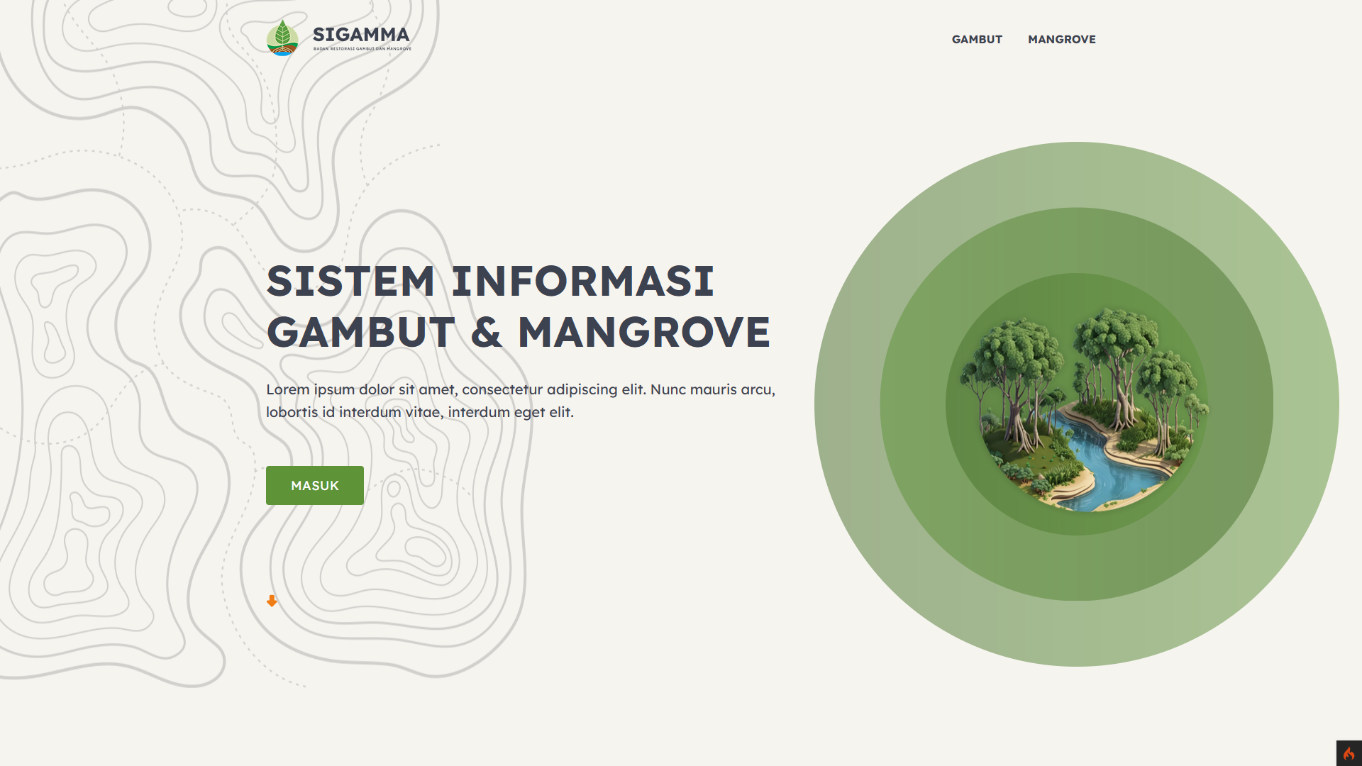
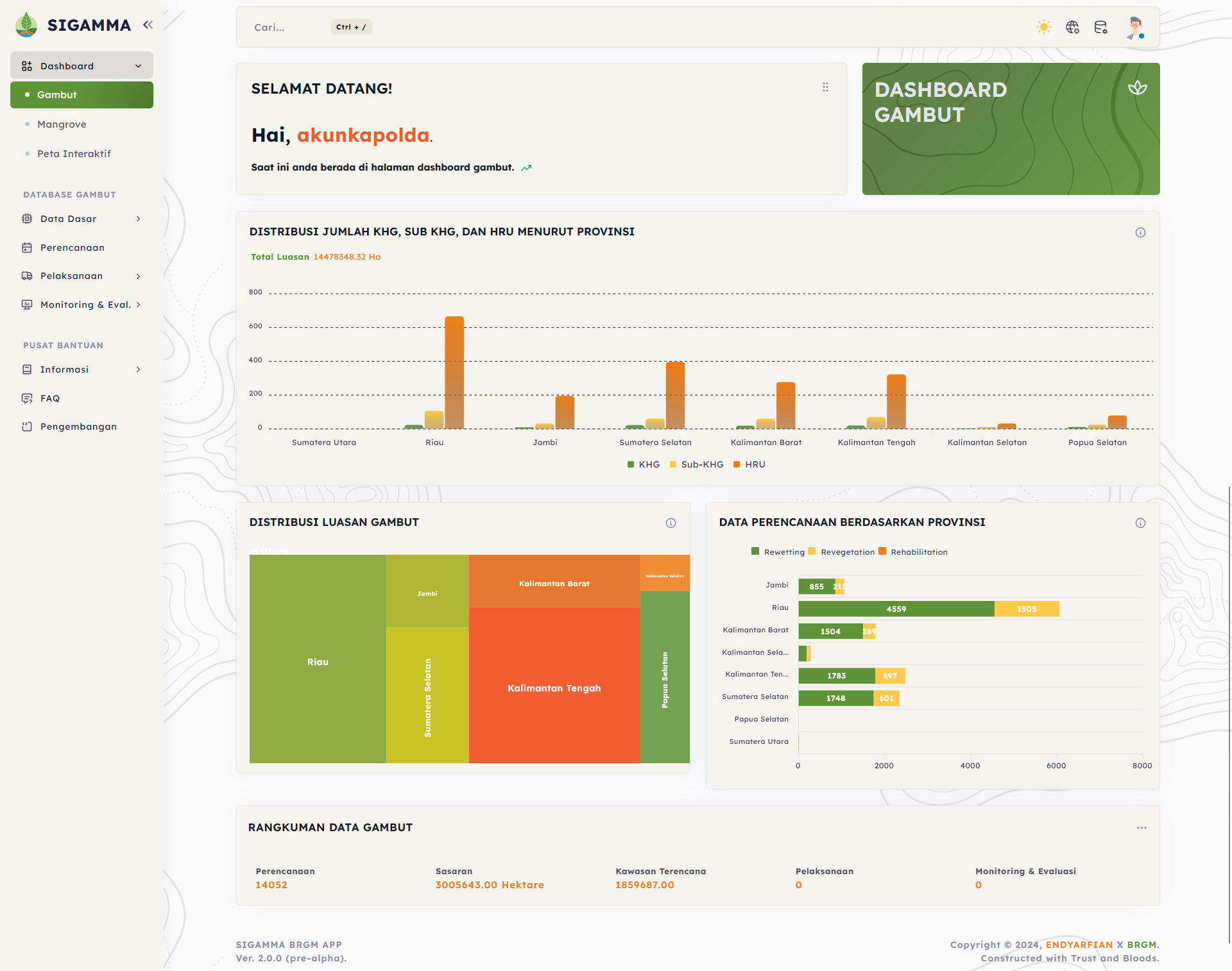
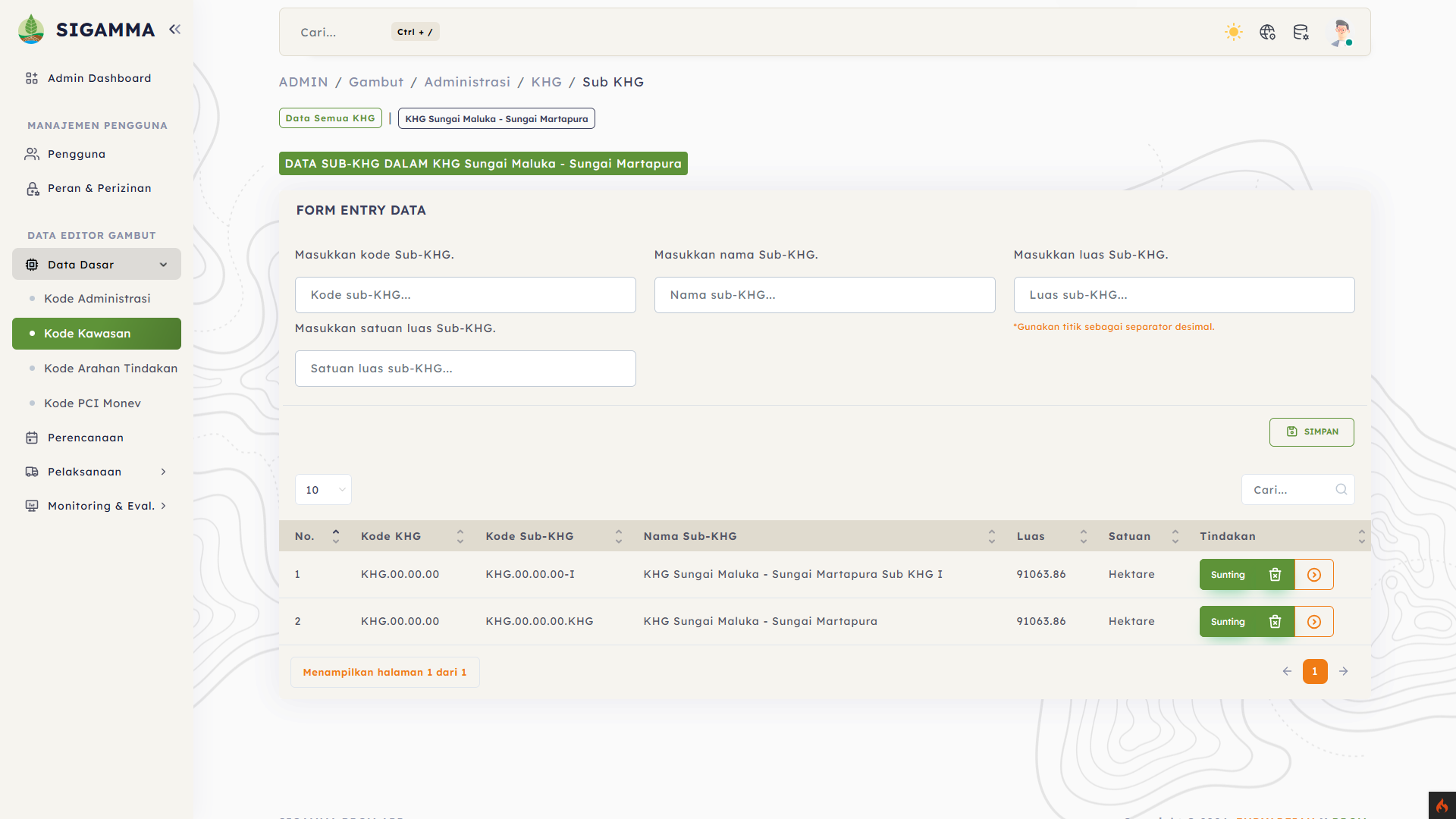
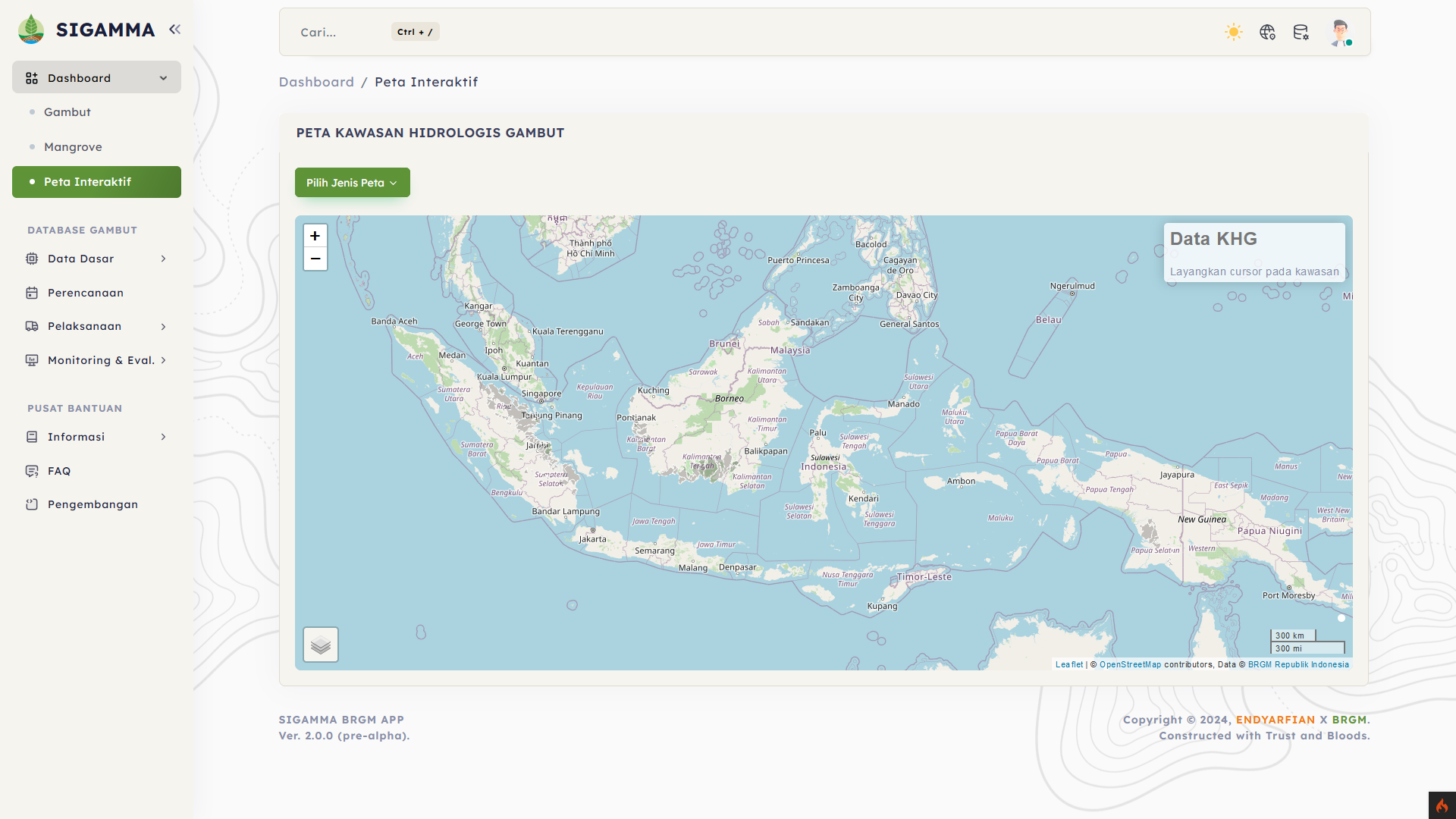
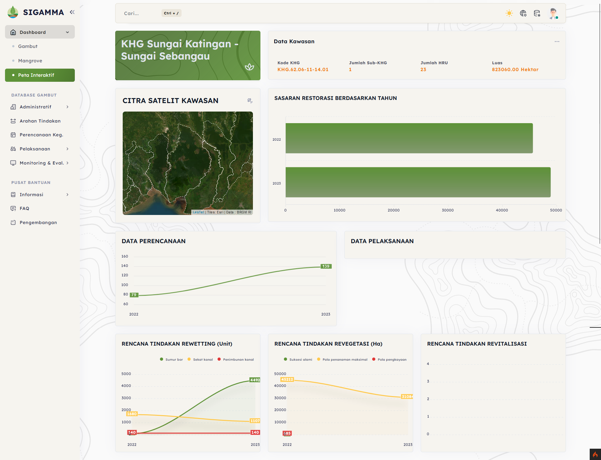
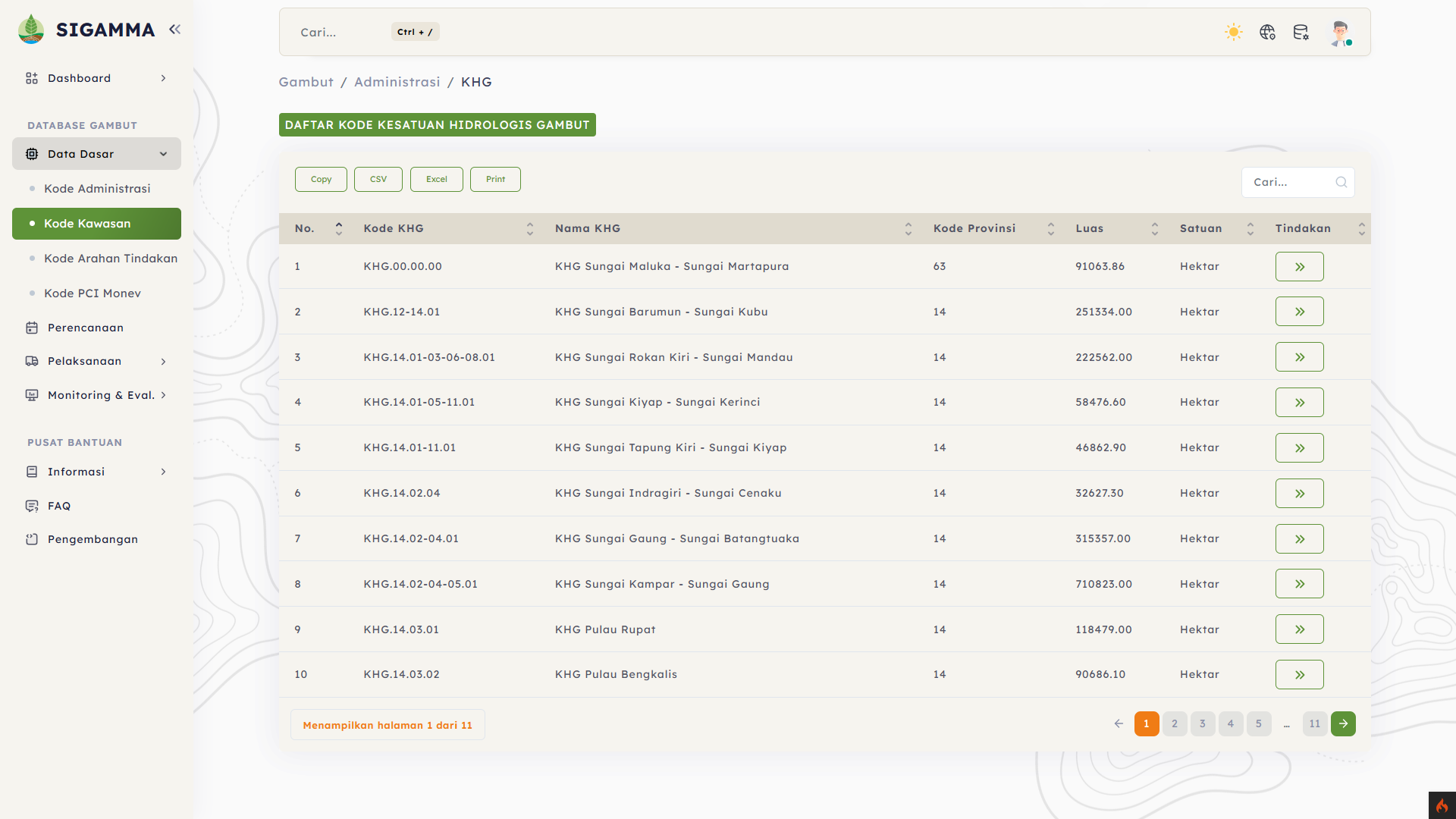
Sistem Informasi Gambut dan Mangrove
Badan Restorasi Gambut dan MangroveSistem informasi Gambut dan Mangrove (SIGAMMA) is a system designed to store and process Peat and Mangrove data, which can be used as a system that can help in the decision-making process and as a tool that can help in the process of managing peat and mangrove areas throughout Indonesia. The main function of this system is the implementation of BRGM business model, namely planning, implementation, monitoring and evaluation of activities carried out by BRGM in managing peat and mangrove areas.
For the frontend in this system, HTML, CSS, and JavaScript are used, while the backend uses PHP with the CI4 framework and postgresql for the database. In the process, there are several obstacles because the system will be used as the backbone and data processor of the pre-existing data retrieval system.
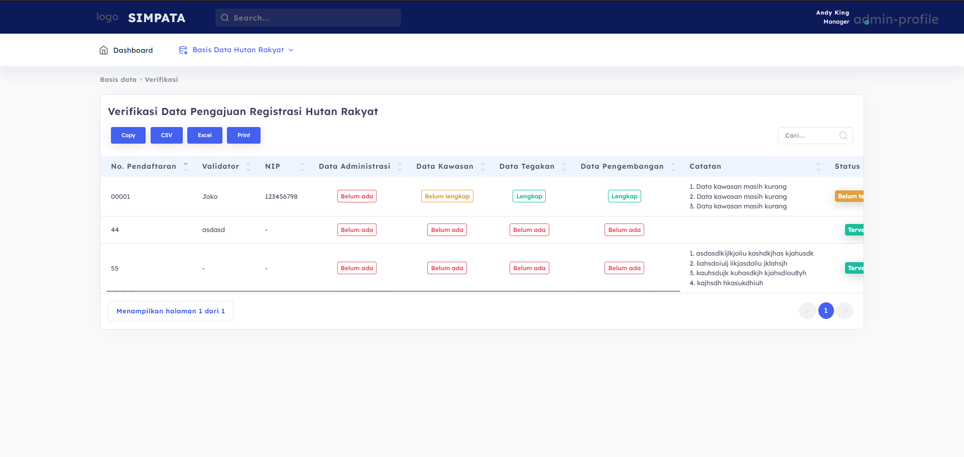
In the development of the Forest Monitoring Information System (SIMPATA), there is one of the activities of registration and inventory of community forests, in this development integrating the existing system and then adding a system that is able to accommodate the registration and inventory of community forests in East Java in particular. the main features in this system are community forest data collection, inventory, and calculation of potential stands using the Case Base Reasoning (CBR) method.
The frontend technology used is HTML, CSS, and JavaScript. while the backend uses PHP with the Laravel framework and MySQL as the database. As for the obstacles, it is to combine the existing system with the system created, besides that it also combines data in the form of spatial data and terrestrial data.
